Key Site Considerations
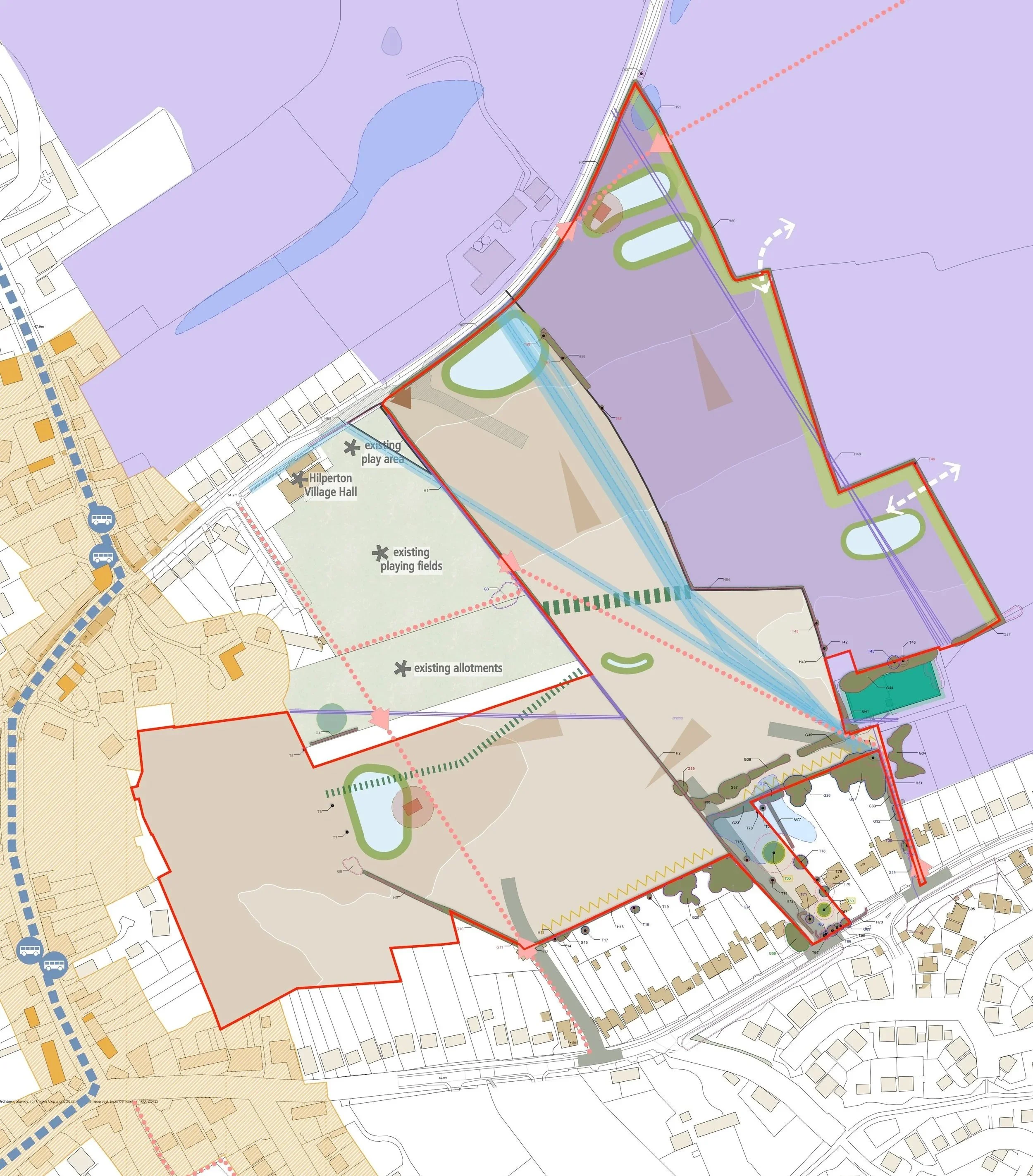
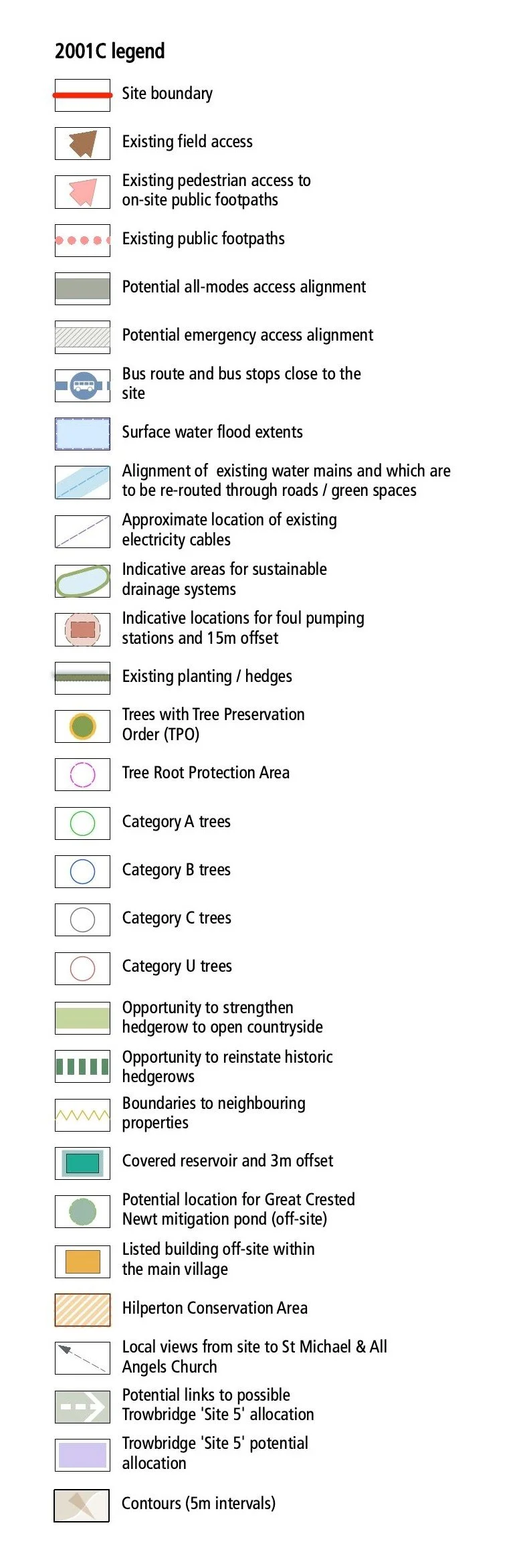
The design work by Barwood Land’s appointed professional team has been guided by a wide range of technical studies and assessments covering all key matters.
This in-depth analysis has identified a number of considerations and opportunities that have informed the scheme proposals. The creation of the illustrative masterplan will ensure a scheme which is both appropriate for the site and crucially, is deliverable in the short-term and underpins the outline planning application.
This work has identified a number of key considerations which are discussed below.
-
As demonstrated through the Local Plan Review, Hilperton is considered to be a sustainable and suitable location for new residential development. The site is also considered to be highly sustainable being well related both local services, facilities and employment opportunities and to existing built development and not being subject to any particular environmental or physical constraints.
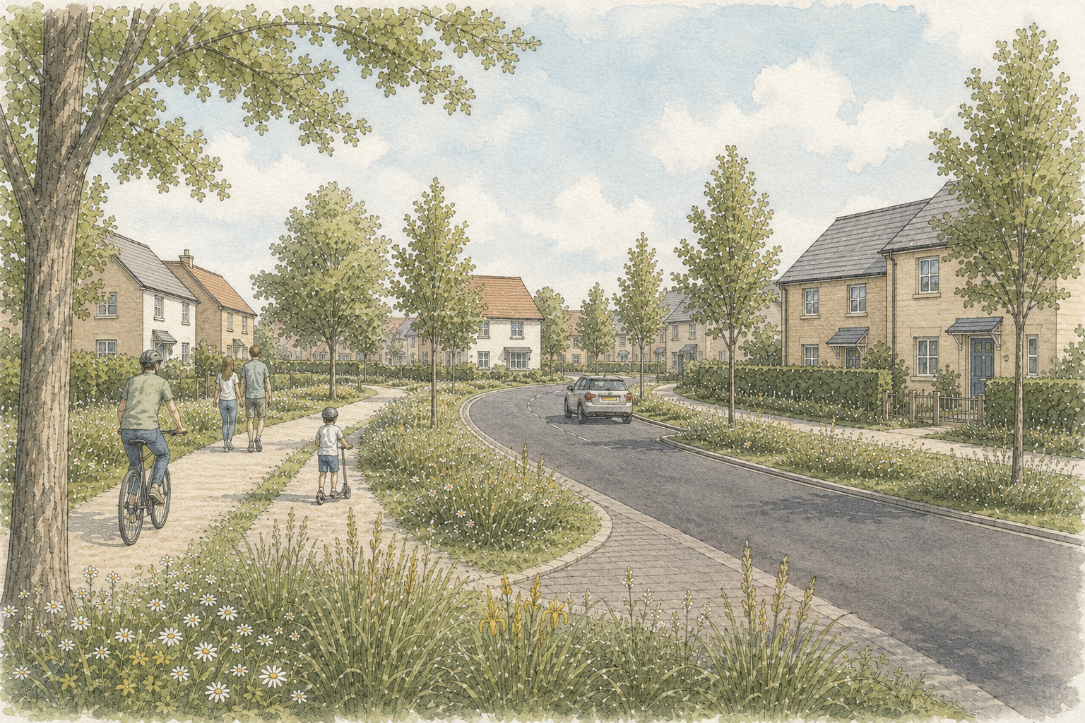
The primary vehicular access into the site is proposed from Devizes Road as shown below, with a secondary access provided off Whaddon Lane which will serve a limited number of dwellings / provide an emergency access.
Every opportunity will be made to connect the development with the village of Hilperton and Trowbridge. There are opportunities on the northern, western and southern boundaries of the site to provide additional pedestrian and cycle connections into Hilperton and Trowbridge via existing footways. The site is within an 11 minute cycle ride of Trowbridge and its many services and facilities. Bus connections are also available within 450m of all parts of the site, with services to Trowbridge in just 8 minutes.
-
An assessment of the significance of designated heritage assets in the vicinity of the site has demonstrated that a low level of less than substantial harm to the significance of the Hilperton Conservation Area is likely as a result of the proposed development, due to the loss of open space within the wider setting of the Conservation Area.
The assessment also concludes that a low level of less than substantial harm to the significance of the Grade II listed Church of St Michael and All Angels is also likely as a result of the proposed development, due to the visible change within its wider landscape setting.
However, the public benefits of the proposals will significantly outweigh the very limited heritage harm. This position has been accepted by the Conservation Officer through pre-application advice received for the site.
In terms of below ground heritage, survey work is ongoing which will determine the significance of any archaeological remains at the site.
-
Landscape impact has been a key consideration from the outset of the evolving masterplan process. The masterplan has been landscape-led with strategic buffers proposed to the east of the site.
The site is not subject to any specific landscape designations. Whilst it is recognised that the development will impact the immediate character of the site, the development would be seen from the wider area in the context of the existing residential development to the west, north and south.
Any potential landscape impact will be appropriately mitigated through the design of the proposed development with significant new planting and open areas with no development on the most sensitive parts of the site. As such new development could be accommodated within the site without significant landscape or visual impacts.
-
All trees and hedges have been surveyed in order that appropriate root protection buffers can be incorporated to the most important and sensitive trees. There are no significant standalone trees within the fields that would be affected by the development. In particular, mitigation measures will be implemented to ensure the preservation of the existing mature tree within the front garden of 177 Devizes Road, which will form the main vehicular access into the site.
Hedgerows contained within the site will be retained where possible and buffered to prevent adverse impacts on any protected species which may be present on the site. The proposed development will include the delivery of at least 10% Biodiversity Net Gain.
-
The Environment Agency’s (EA) ‘Flood Risk from Rivers or Sea’ mapping shows that the entirety of the site is within Flood Zone 1 (the lowest risk of flooding).
The EA’s ‘Flooding from Surface Water’ mapping shows the entirety of the site to be at ‘very low risk’ of flooding form surface water, with less than 0.1% chance of flooding each year.
The proposed surface water drainage scheme for the site comprises the inclusion of attenuation basins within the site in accordance with the requirements of the Local Lead Flood Authority. This ensures that the development would not result in flooding elsewhere.
-
Ecological surveys have been undertaken in accordance with best practice guidance and following consultation with Wiltshire Council regarding survey methodology and scope. In particular, full regard has been had to the requirements of the Trowbridge and Westbury Bat Mitigation Strategy (2025).
The Site comprises predominantly arable fields with areas of grassland bounded by native hedgerows and mature trees, together with localised scrub and ruderal vegetation.
No statutory designated sites occur within or adjacent to the Site. European designated sites within 10km of the Site boundary comprise:
Bath and Bradford on Avon Bats SAC 8.2km to the north-west.
Salisbury Plain SAC and Special Protection Area (SPA) 8.6km to the south-east.
Nationally and locally designated sites within 5km include Green Lane Wood LNR, Picket and Clanger Wood SSSI and four Local Wildlife Sites, including Kennet and Avon Canal LWS (1.1km from the Site). Subject to survey confirmation, potential ecological receptors within the Site include hedgerows, trees, grassland habitats, bats (roosting, foraging and commuting activity), breeding birds, amphibians (including Great Crested Newts), reptiles, badger and hazel dormouse.
Mitigation will be embedded within the site layout and design, including retention and buffering of key habitats such as hedgerows and mature trees. Mitigation and enhancement measures will include:
Provision of SANG and on-site recreation opportunities in accordance with the Trowbridge and Wiltshire Bat Mitigation Strategy (TWBMS).
Retention of key bat commuting and foraging corridors in accordance with the TWBMS.
Sensitive lighting design in accordance with the TWBMS.
Habitat creation including meadow grassland, native woodland, native scrub and wetland habitats.
Species enhancement measures including bird, bat and invertebrate boxes.
Delivery of a minimum 10% Biodiversity Net Gain, prioritising on-site provision in accordance with the mitigation hierarchy.
Construction and long-term habitat management measures are anticipated to be secured through a Construction Ecological Management Plan and Habitat Mitigation and Management Plan.
The surveying undertaken to date reveals no ecological factors that would halt the proposed development of this site. All potential impacts can be appropriately mitigated through a combination of licensing, precautionary working methods, and habitat creation and enhancement measures. Subject to the implementation of standard mitigation and enhancement practices, it is considered that ecological impacts associated with the development can be suitably avoided or mitigated, with opportunities for biodiversity enhancement also possible.